Let’s walk on some ice
Songdal and Nigardsbreen
From Odda we drove about there hours north to the resort village of Sogndalfjora (also known as Sogndal). The town provides a good selection of overnight accommodations, restaurants and grocery stores. Sogndal is located fairly close to Nigardsbreen and Jostedalsbreen national park. In case you are wondering the Norwegian word ‘breen’ means glacier in English.


Sogndalsbreen as scene from our hotel room at dusk or about midnight local time.
The map at left shows Sogndalsfjora in relation to Jostedalsbreen and Nigardsbreen.
Nigardsbreen
Nigardsbreen is an arm (also referred to as outlet) of the massive Jostedalsbreen ice cap. Jostedalsbreen is the largest glacier in Europe having a total area of 487 square kilometers (310 sq mi). Nigardsbreen is one of 50 glacial arms. I found two versions of the name origin of Nigardsbreen. One story says it’s named after a family farm that the glacier crushed during several decades of growth from 1700 to 1748. The other story says nine farms were destroyed by the same glacial expansion, thus taking its name from the Danish ‘Ni gårde’ (nine farms).
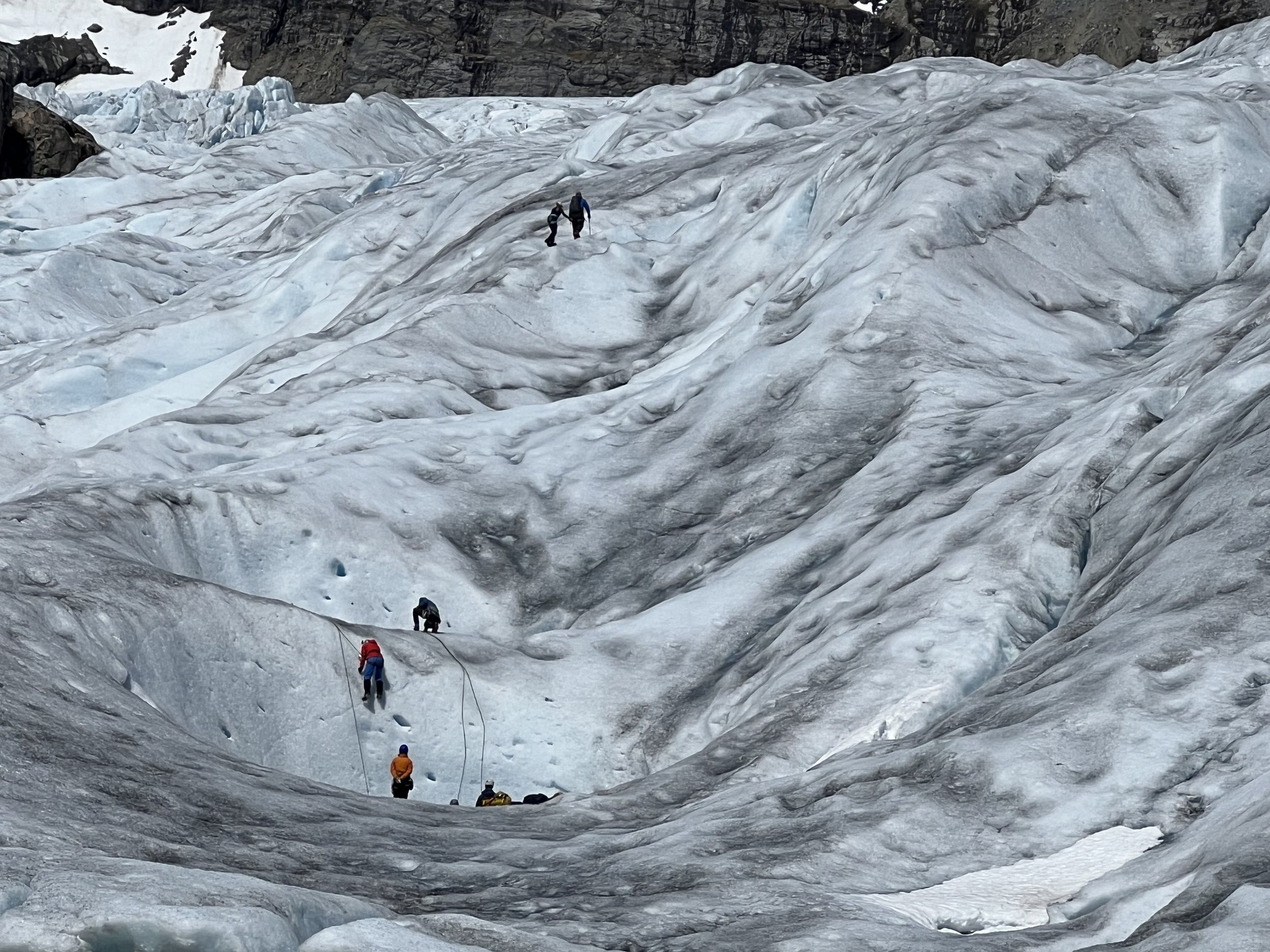
I made a reservation several weeks in advance with a tour guide. Jostedalen Breførarlag had many great reviews so I booked the Short Blue Ice Hike for my daughter and I. The total duration of the trip is about 5 and a half to 6 hours with about two hours walking on the glacier. We joined 27 other tourists at the Nigardsbreen point parking lot where we met our guide Mani and two Nepalese guides. They provided harnesses, crampons, ice ax, helmet and gloves. The large group was ferried to the other side of a small lake in groups of nine to a dock on the other side. We hiked about a kilometer to where the glacier began. While there we stopped for instruction about how to lace up our crampons. The guides handed out three ropes and divides us into three groups. Each group having donned crampons, harnesses and roped in, guides and guests were now ready embark to the ice.

Let your eyes follow the gulch from the lake to that white patch. That is the receding end of Nigardsbreen. It may look small here, but scale in the mountains is deceiving.

The trees in the foreground provides some indication of scale. In the lower left you can see a pedestrian bridge that crosses the rushing glacier melt.

We ferry across the lake from the Nigardsbreen parking lot in groups of nine to the shoreline to start the 1 kilometer trek to the glacier.

We stop for photos before gearing up.
Another group in our party pauses for lunch.
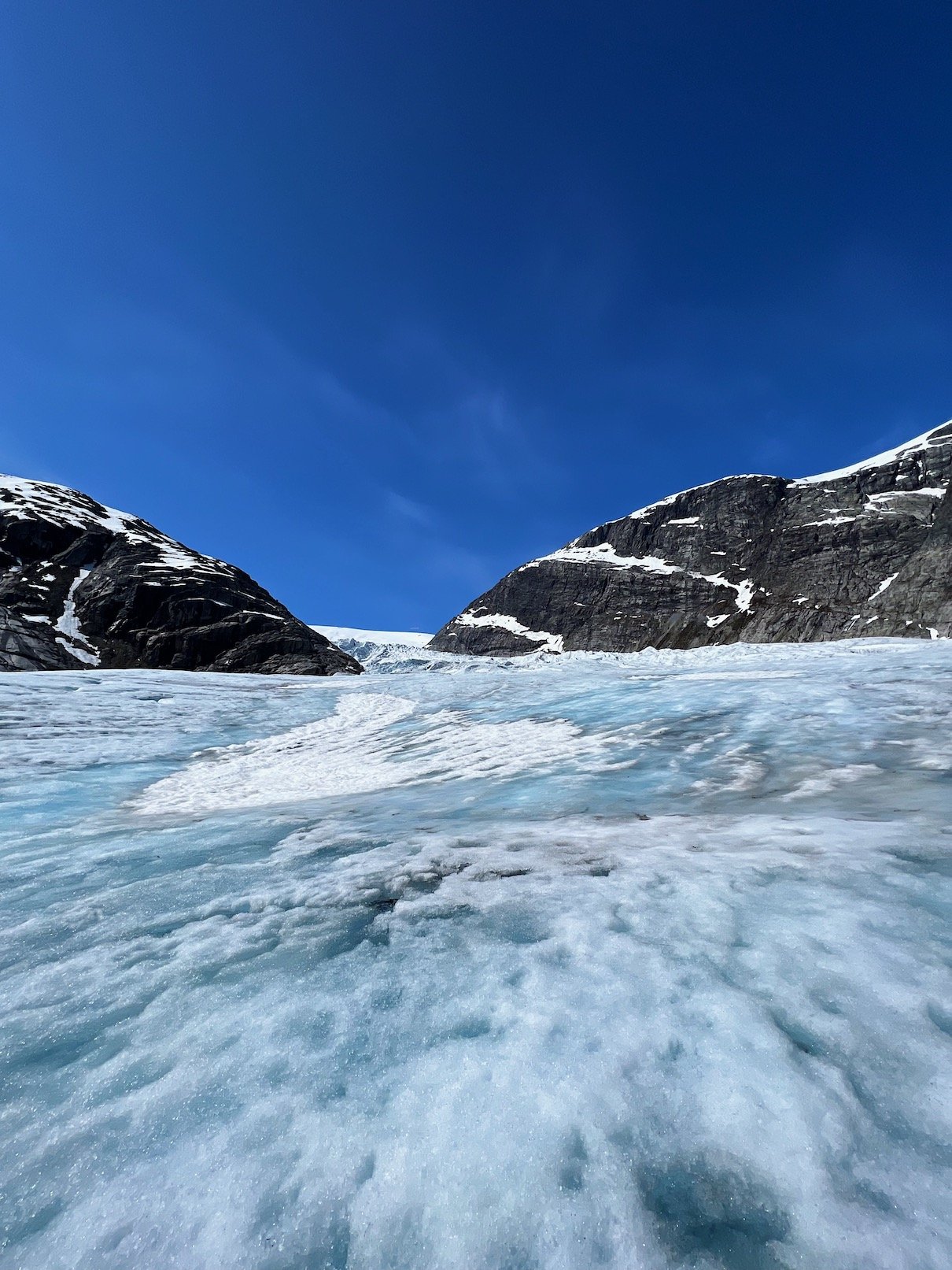
The glacial surface melts in the warmth of June sunshine.
I love the sound of crunching ice in the morning.
On the return the guides paused allowing for picture taking.
Drips, but no calving, at least not while we were there.

A moment frozen in time. Notice the white patch of snow behind us. Our guides instructed us not to walk there, because they may conceal a crevasse.

Looking up from our location on the glacier.

The early June sunshine melts snow above Nigardsbreen.
Final Thoughts
I have a few criticisms about this glacier hike. Beyond the actual hike there was absolutely no educational component. No one spoke to us about this particular glacier or glaciers in general. Melting glaciers feature prominently everywhere in the news, albeit sensationalized along with the typical climate change hysteria. Besides acting as kind of a regulator for Earth’s climate, in many parts of the world their run off provide navigable waterways and drinking water for possibly a few billion people.
To learn more about glaciers I highly recommend viewing the video "What are glaciers?" produced by the University of Alberta. This is part of an an outstanding online course called "Mountains 101".