
After two days in Bergen we rented a car and drove east to the small town of Odda. Odda sits at the southern end of the Sørfjorden. The Sørfjorden is one of the innermost branches of the main Hardangerfjorden. Odda is also the town where tourists stay who are interested in hiking the famous Trolltunga.

The two and a half hour drive to Odda includes a scenic ferry crossing over the Hardangerfjord.

Sleepy Sunday street scene in the small town of Odda, Norway.
Trolltunga ("troll tongue") is a rock formation situated about 1,100 metres (3,600 ft) above sea level. The cliff juts horizontally out from the mountain, about 700 metres (2,300 ft) above the north side of the lake Ringedalsvatnet. Depending upon which parking lot you start the hike can take from 7 to 12 hours round trip to complete. With an elevation gain of 4,035 feet the Trolltunga hike is very demanding. It would have been nice to say that we attempted and completed the hike. However, an Odda local said we should definitely hire a guide since there was considerable snowpack still on the trail. We didn’t have a guide and didn’t have time to hire one. This warning together with the long and physically demanding nature of the hike persuaded us to investigate other hiking options. It’s just as well. On a pleasant day hundreds will make the pilgrimage to Trolltunga resulting in a hiker traffic jam as everyone waits in line for their Instagram moment. See The depressing reality behind one of Instagram's most popular nature shots revealed.

Trolltunga from the web site visitnorway.com. All hikes begin with a first step. We never took that step opting instead for a more moderate and safer option..
After consulting Alltrails.com the Nedre (Lower) Buarbreen hike was just right. It’s a hike that is not too easy, not too hard, but still take your breath away for all the right reasons. AllTrails says,
“This hike takes you along a steep trail through the varied landscape to the glacier's edge. This landscape is particularly wild and beautiful, with lots of water and rushing mountain streams.”

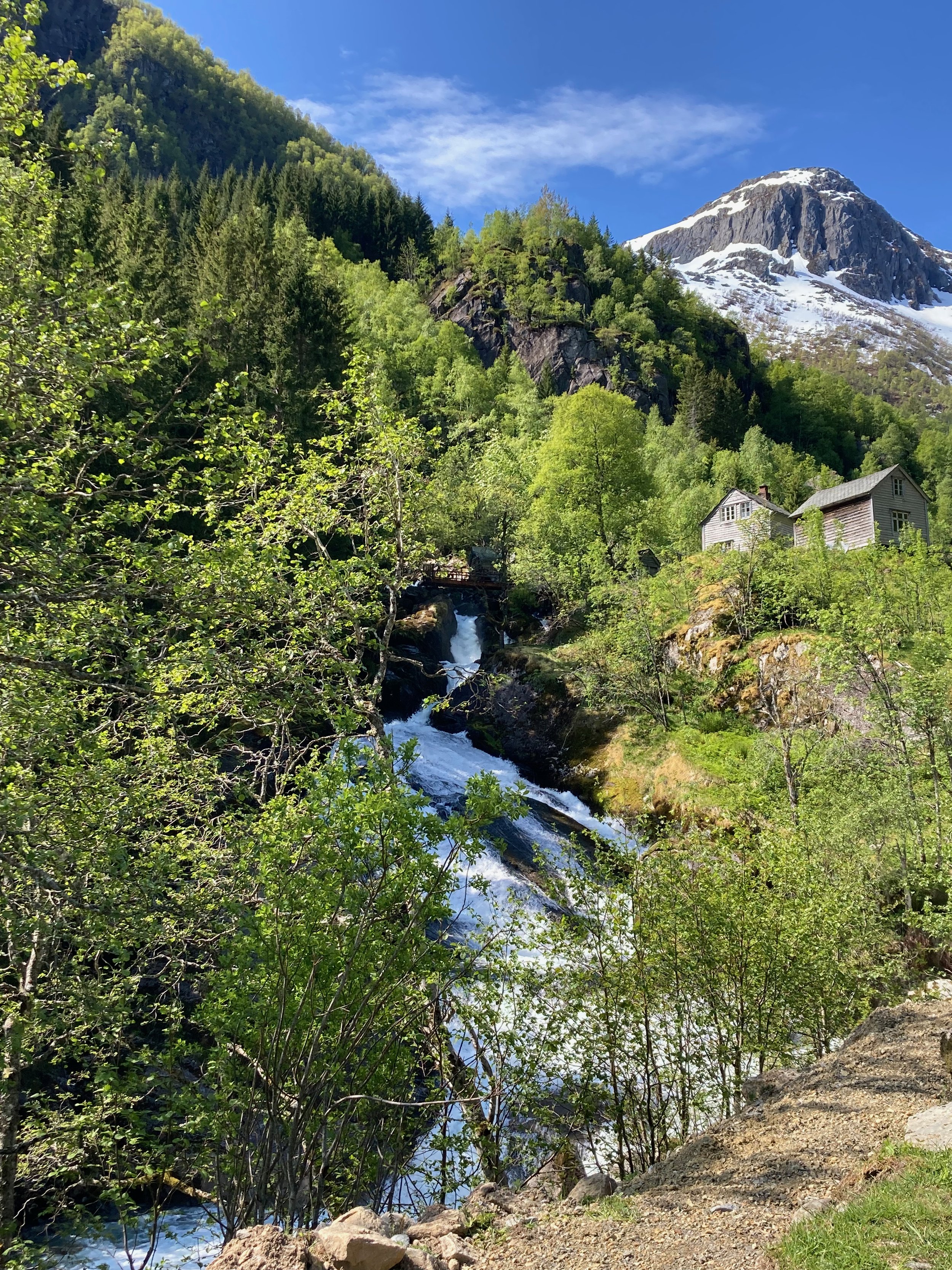
Waterfalls are everywhere as you start the ascent.
Rushing mountain stream.

After the first set of bridges ropes are available to hoist oneself up fairly steep boulders.

I definitely needed the assist.

Some people were still using this frayed rope.

The ridge line is on the other side of this peak.

Climbers using ropes to pull themselves up. One of the ropes is very worn and could be dangerous.

Follow the signs.
We found ample parking available when we arrived at about 9:00 AM. Make your way past what looks like a farm house and enter through the closed gate. Be sure to secure the gate behind you so livestock won’t wander out. You will hike on flat farm land next to a stream for barely half a kilometer before the first hill.

The beginning is a little boring, but you’ll have the sound of a flowing stream to accompany you as you walk.

Navigating over large rocks is quite manageable early on.

Ropes are provided for safety.

Father and daughter before the big ascent.
